Parishes are units of territory that were originally set up by church bodies. These units were then also used as civil administrative areas. Over time, the boundaries of civil and ecclesiastical parishes came to vary from each other. The boundaries shown on the map are the more recent civil parish boundaries (according to the Census of Population 1961: Topographical Index (HMSO, 1962).
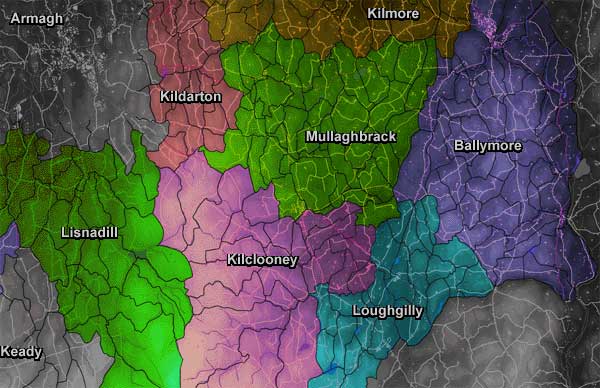
Markethill and District covers an area within the civil parishes of Ballymore, Kilclooney (or Kilcluney, in its modern spelling), Kildarton, Lisnadill, Loughgilly and Mullaghbrack (or Mullabrack).
The latin name for a civil parish is Quod Civilia; ecclesiastical parishes were called Quod Sacra. Where the boundaries of a civil and ecclesiastical parish coincide, the parish was called a Quod Omnia.