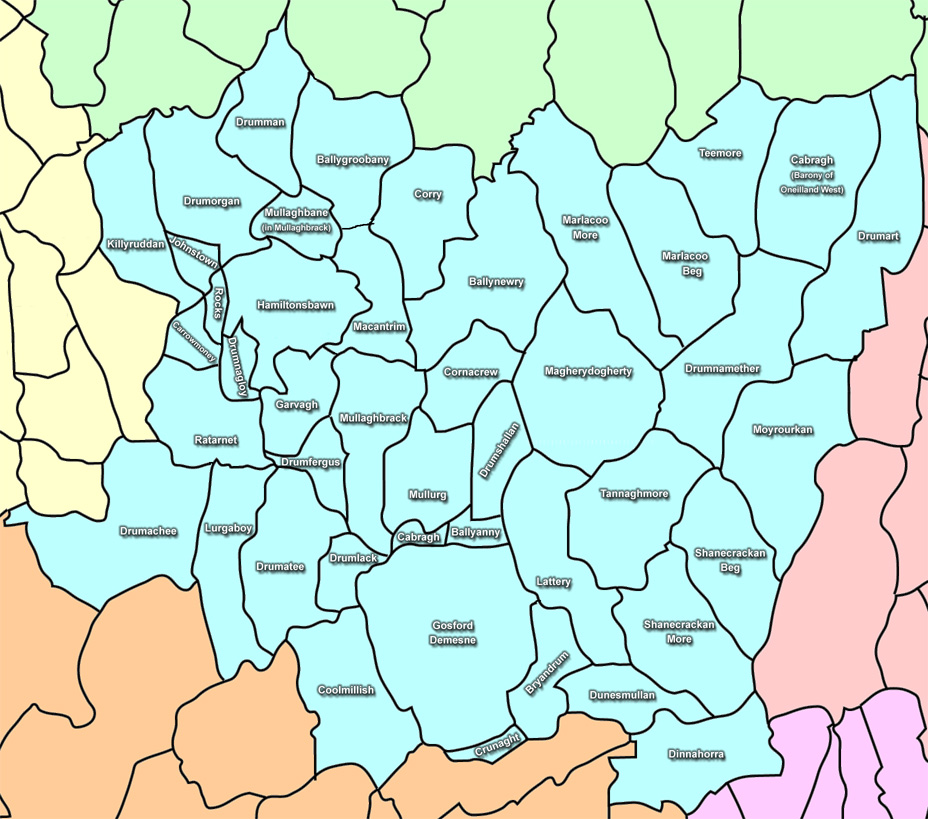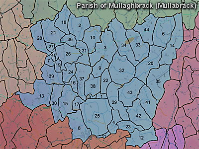
The parish of Mullaghbrack is in the county of Armagh. The following townlands are in this parish:
The parish was described in 1838 in the Ordnance Survey Memoirs:
"Locality
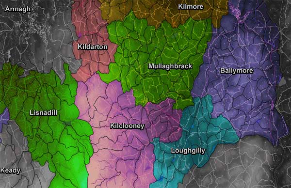
"The parish of Mullaghbrack is situated nearly in the centre of the county of Armagh, partly in the baronies of Oneilland West and Lower Fews, bounded in the north and south by the parish of Kilmore, to the south by the parish of Kilclooney, to the east by the parish of Ballymore and to the west by the parish of Armagh, its extreme length from east to west being 5 and three-quarter miles and extreme breadth from north to south 4 and a half miles. It contains 11,557 acres 6 perches, which are divided between the 2 baronies as follows: in Oneilland West 3,656 acres 8 perches, including water 53 acres 19 perches; in Lower Fews 7,900 acres 3 roods 38 perches including water 40 acres 2 roods 20 perches. Total water contained in parish 92 acres 2 roods 39 perches.
"Lakes
"The lakes in this parish are Moyrourkan lough, situated in the eastern part of the parish 2 miles north east of Markethill, divided between 4 townlands and elevated to the height of 254 feet above the level of the sea, is three-quarters of a mile iong from the north east to the south west and 220 yards broad from north west to south east. Marlacoo lake, situated in the north eastern part of the parish 3 and a half miles south east of the town of Richhill, is situated 230 feet above the sea. Length from north east to south west 600 yards. Breadth from north west to south east 230 yards: It is partly in the townland of Marlacoomore and partly in Marlacoobeg. Ballynewry lake, situated nearly three-quarters of a mile south west of Marlacoo lake, is elevated 252 feet above the sea, length from north east to south west 285 yards, breadth from north west to south east 200 yards. It is situated partly in the townland of Cornacrew and partly in the townland of Ballynewry...
"Roads
"The principal roads which pass through this parish are the mail coach road from Armagh to Dublin through Markethill, Newry, entering this parish at its south western extremity, runs nearly along the boundary to the end of Newry Street (Markethill) where it enters the parish of Kilclooney, its length being for that distance 2 miles and average breadth 32 feet clear of drains and fences. It is macadamised and kept in good repair at the expense of the county.
"The road from Richhill to Newry, which joins the mail coach road from Armagh at the distance of a quarter of a mile to the north north west of Markethill, enters the parish of Mullaghbrack near its northern extremity and crosses it in a south south easterly direction to its junction with the Armagh mail coach road, its length being 3 and a half miles and average breadth being 22 feet. It is macadamised and kept in good repair.
"The road from Markethill to Tanderagee crosses the eastern portion of the parish in a north easterly direction for the distance of 3 and three-quarter miles, its average breadth being 21 feet clear of drains and fences. It is macadamised and kept in good order.
"The road from Armagh and Markethill through Pointzpass and Banbridge branches off in an easterly direction from the Markethill and Tanderagee road at the distance of 1 mile from Markethill, its length being from that point 1 and a quarter miles and average breadth 24 feet. It is macadamised and kept in good order.
"The road from Armagh to Tanderagee traverses the northern portion of the parish in a direction nearly east and west for the distance of nearly 5 and three-quarter miles, its average breadth being 24 feet. It is macadamised and kept in good order.
Also, half a mile of the road from Markethill to Keady in an east south east direction, average breadth being 21 feet, macadamised and in good order. " (Ordnance Survey Memoirs 1835-38)