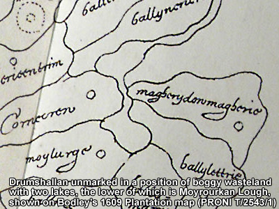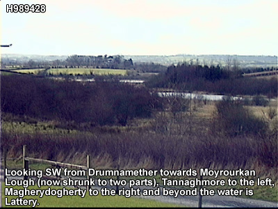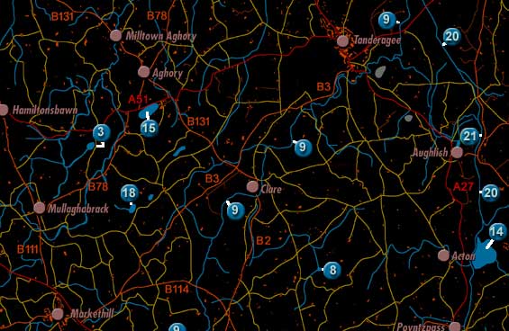
Moyrourkan Lake is labelled 18 on the map. It is North North East of Markethill, to the East of Mullaghbrack.
The lake was described in 1838 in the Ordnance Survey Memoirs: "Moyrourkan lough, situated in the eastern part of the parish [of Mullaghbrack] 2 miles north east of Markethill, divided between 4 townlands and elevated to the height of 254 feet above the level of the sea, is three-quarters of a mile iong from the north east to the south west and 220 yards broad from north west to south east. "