Poyntzpass is today designated as a village. It lies 9.7 km east of Markethill.
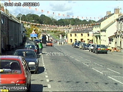
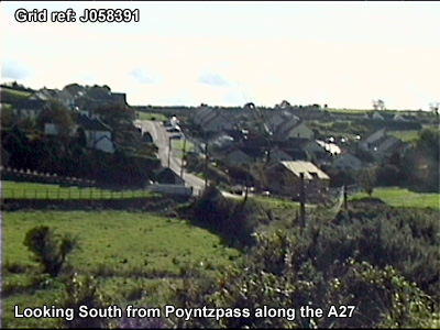
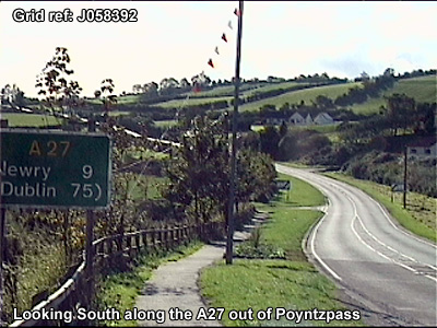
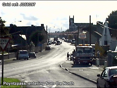
"Poyntzpass was established in 1790 and is a crossroads settlement located on the main Portadown-Newry (A27) Road about 10 miles south-east of Armagh. Since 1971 its population appears to have declined slightly to an estimated 370. The village lies in a north-south corridor that carries the Belfast-Dublin railway line and the now disused Newry-Portadown canal. Previously a canal port and a railway collection point, the village now has an important cattle market. A small part of the village to the east of the canal lies within the Banbridge District Council area...The village has an attractive natural setting but the topography does present problems for development because of the quite steep slopes. Some of the more low-lying land in the settlement is subject to flooding." (Armagh Area Plan 2004: Armagh District Council Area)
McKay, P A Dictionary of Ulster Place-names (Belfast, 1999) notes:
The town was described in 1838 in the Ordnance Survey Memoirs:
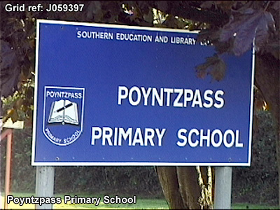
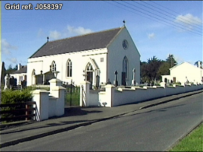
"The village of Poyntzpass is situated on the east boundary of the parish in the townlands of Federnagh and Tullinacross, and derived its name from Sir Toby Poyntz of Brannock Hall, Acton, who was appointed to watch this pass as well as those of Scarva and Jerrett <Gerrard> in the reign of William III. It is now the property of Colonel Close of Drumbanagher. It contains a small plain church with a turret and would accommodate about 300. It was built in 1796. There is a schoolhouse in the east end of the village, purchased by Colonel Close in 1828 assisted by the Kildare Street Society, whose books and system are still retained. There are 60 males and 50 females instructed in it. Colonel Close gives a yearly salary to the master and mistress.
A manor court is held on the first Saturday of every month, seneschal Mr Mitchell, Markethill. The jurisdiction of the court extends to debts, fines, and damages under 5 pounds. There is also a court leet once a year, generally in April or May, to decide on trespass, poundage, local improvements; the seneschal attends. The townlands in the manor are half of Carrickbrack, Corcreen, Ballinaleck, Ballyreagh, Tullinacross, Federnagh, half of Tannyokey <Tamyokey>, Tullylime, Crewmore, Acton, Brannock, Glassdrummond, Ballynagreagh and 8 townlands in the parish of Loughgilly.
...The town of Poyntzpass is situated on the road between Tanderagee and Newry, at the distance of 4 and a half miles to the south east of the former and 8 and three-quarters nearly north of the latter. On approaching the village from the Newry road its general appearance is good. It is situated in a hollow at the foot of several round hills on the banks of the canal. At the distance of a quarter of a mile to the northward is the residence of Mr Dobbs, J.P., a large square house of a plain and comfortable appearance. The town on a closer inspection presents a more unfavourable aspect: the houses are built of stone and generally white-washed. The following is their number: 3-storey houses 2, 2-storey houses 86, 1-storey houses 5, mud cabins 22.
"...Poyntzpass: Trades and Occupations: Spirit dealers 9, grocers 2, haberdashers 2, apothecaries 3, bakers 1, reedmakers 1, shoemakers 3, nailmakers 1, hardware shop 1, painter and glazier 1,1odging house keepers 4, tailors 2, dispensary 1, smith 1." (Ordnance Survey Memoirs 1835-38)