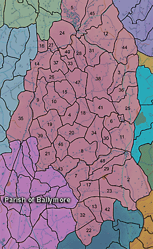
The townland of Brannock is in the parish of Ballymore in Armagh County. It is labelled number 11 on the map.
The Ordnance Survey Memoirs of 1835-38 note:
"A flax mill, situated quarter of a mile nearly to the westward of the town of Poyntzpass ...is the property of Alexander Crothers. The following are its dimensions: nature of wheel breast, diameter 16 feet, breadth 3 and a half feet, fall of water 19 feet, water wheel and inner works of metal, consists of 1 storey in good repair, situated in the townland of Brannock...
"There are no natural woods in this parish. It, however, contains about 403 acres of forest trees, of which 95 acres are in Derryallen, 75 in Skigatallagh, 16 in Demone, 50 in Brannock, 40 in Clare, 25 in Cargans, 20 in Druminaleg, 14 in Tullyhue, 12 in Moodoge and 12 in Druminure...
"In the north west of the townland of Brannock a quarter of a mile from Acton there are the ruins of an old church and on a stone in the burial ground is the following inscription: "This church was built at the sole expense of Sir Toby Poyntz, Knight, the son of Charles Poyntz, Knight, of Acton, Anno Domini 1684 and dedicated to the" the remainder is unintelligible. Besides the above the parish contains a number of forts but none worthy of particular remark.(Ordnance Survey Memoirs 1835-38)
The Environment and Heritage Service Sites and Monuments Record (2002) notes the following in this townland:
BAWN of the Seventeenth Century
SMR NO: ARM 018:039
Irish Grid Reference: J05804098
Townland: BRANNOCK
CONDITION: No visible remains
The site was built by Sir Toby Poyntz and was described in 1619 as: "... a Bawne of 80 feet square, the lower part whereof is of Stone and Clay, with a house in it; but he, not liking of the seat, hath begun a Bawne of 100 ft square, with 3 Flankers, and a large House which shall be of Brick & Lyme. " Lewis wrote in 1837 "Sir Toby Pointz... erected a bawn 100 ft square, a house of brick & lime for his own residence and 24 cottages for so many English settlers... "
BIBLIOGRAPHY:
HILL, G.1877,
571 LEWIS, S.1837, Vol. 1, 7
TREADWELL, V. UJA 23, 1960, 126-37
PRONI records: OS/6/2/18/1 (Surveyed 1835. Engraved 1835.); OS/6/2/18/2 (Surveyed 1835. Engraved 1835. Revised 1860. Engraved 1863.); OS/6/2/18/3 (Surveyed 1835. Revised 1906. Published 1908.); OS/6/2/18/4 (Surveyed 1835. Revised 1906. Published 1908. (2 copies - 1st a reprint 1930, 1933 and 2nd reprint 1933, 1939, 1942, 1946, 1955.); OS/6/2/18/5 (Surveyed 1906. Revised 1954-5. Levelled 1892, 1901-2, 1904 and 1906. Published 1958 (2 copies).); VAL/1B/214 (1st valuation records.); VAL/12B/15/23A, VAL/12B/15/23B, VAL/12B/15/23C, VAL/12B/15/23D, VAL/12B/15/23E (Valuation annual revision list.); VAL/2B/2/32C (Griffith valuation list.).