 J007391
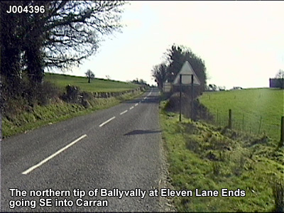
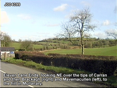
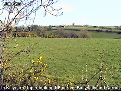
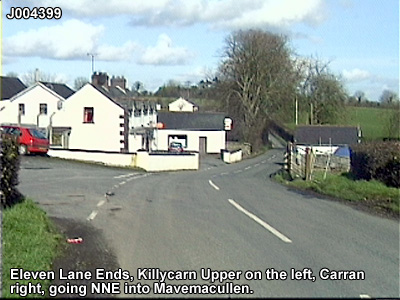
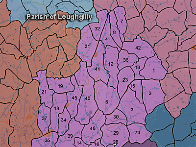
The townland of Carran is in the parish of Loughgilly in Armagh County. It is labelled number 8 on the map.
The Environment and Heritage Service Sites and Monuments Record (2002) notes the following in this townland:
Rath from the Early Christian Period.
SMR NO: ARM 017:018
GRIDREF: J00773881
CONDITION: TRACES ONLY
"Parish: Loughgilly or Drumachose. Barony: Orior Lower or Keenaght. A low, circular platform 44m EW x 40m N-S. The S perimeter is defined by a curving hedge boundary & a scarp falling c.1 m to a road. At N, cultivation has eroded the site & only a gentle scarp can be seen. An enclosing bank survives intermittently around the S side. This varies, but is generally 2. 5m wide x 0.6-1.2m high. A short length of ditch originally c.3.6m wide is visible S & W. Recutting has emphasised this. See SM7 for further details "
Check records (Adrian) Creggan parish
PRONI records: D.1166 (Maps.); OS/6/2/27/1 (Surveyed 1834-35. Engraved 1835.); OS/6/2/27/2 (Surveyed 1834. Engraved 1835. Revised 1861. Revisions engraved 1863.); OS/6/2/27/3 (Surveyed 1834. Revised 1906-07. Published 1909. Reprinted 1929.); OS/6/2/27/4 (Surveyed 1907. Revised 1956. Levelled 1904. Published 1959 (2 copies).); OS/6/2/30/1 (Surveyed 1835. Engraved 1835.); OS/6/2/30/2 (Surveyed 1835. Engraved 1835. Revised 1862. Revisions engraved 1863.); OS/6/2/30/3 (Surveyed 1835. Revised 1907. Published 1909. Reprinted 1928.); OS/6/2/30/4 (Surveyed 1907. Revised 1956. Levelled 1903-04. Published 1960 (2 copies).); OS/6/2/17/1 (Surveyed 1835. Engraved 1835.); OS/6/2/17/2 (Surveyed 1835. Engraved 1835. Revised 1860. Engraved 1863.); OS/6/2/17/3 (Surveyed 1835. Revised 1906. Published 1908. Reprinted 1929, 1932.); OS/6/2/17/4 (Surveyed 1906. Revised 1954-5. Levelled 1889, 1892 and 1906. Published 1958 (2 copies).); VAL/1B/219, VAL/1B/240A (1st valuation records.); VAL/12B/10/3A, VAL/12B/10/3B, VAL/12B/12/2A, VAL/12B/12/2B, VAL/12B/12/2C, VAL/12B/12/2D, VAL/12B/12/2E, VAL/12B/15/23D, VAL/12B/15/23E (Valuation annual revision list.); VAL/2B/2/14B, VAL/2B/2/34A (Griffith valuation list.).
J007391