 J019373
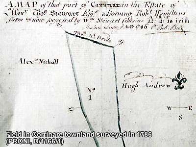
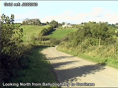
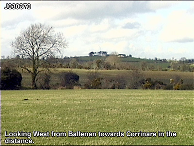
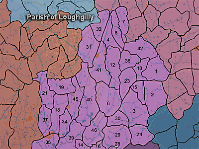
The townland of Corrinare is in the parish of Loughgilly in Armagh County. It is labelled number 13 on the map.
The Environment and Heritage Service Sites and Monuments Record (2002) notes the following in this townland:
Rath and possibly a souterrain of the Early Christian Period.
SMR NO: ARM 017:029
GRIDREF: J01833737
CONDITION: SOME REMAINS [of the rath]
"The site is very eroded & only a low, flat-topped mound sloping down to S can be seen. The W, S & E sides are ill-defined, but a slight scarp falling c.1m to the surrounding ground survives. The perimeter on the N coincides with the townland boundary and is clearly visible. Here there is a ditch 4.5m wide & c.1 m deep below the interior & c.1 .8m below external ground level. The site measures approx. 40m EW x 44.5m N-S. Paterson records a souterrain in NW quadrant of the interior, but this cannot be seen.
BIBLIOGRAPHY: PATERSON,T.G.F., MS.135."
PRONI records: OS/6/2/17/1 (Surveyed 1835. Engraved 1835.); OS/6/2/17/2 (Surveyed 1835. Engraved 1835. Revised 1860. Engraved 1863.); OS/6/2/17/3 (Surveyed 1835. Revised 1906. Published 1908. Reprinted 1929, 1932.); OS/6/2/17/4 (Surveyed 1906. Revised 1954-5. Levelled 1889, 1892 and 1906. Published 1958 (2 copies).); OS/6/2/18/1 (Surveyed 1835. Engraved 1835.); OS/6/2/18/2 (Surveyed 1835. Engraved 1835. Revised 1860. Engraved 1863.); OS/6/2/18/3 (Surveyed 1835. Revised 1906. Published 1908.); OS/6/2/18/4 (Surveyed 1835. Revised 1906. Published 1908. (2 copies - 1st a reprint 1930, 1933 and 2nd reprint 1933, 1939, 1942, 1946, 1955.); OS/6/2/18/5 (Surveyed 1906. Revised 1954-5. Levelled 1892, 1901-2, 1904 and 1906. Published 1958 (2 copies).); OS/6/2/21/1 (Surveyed 1834-35. Engraved 1835.); OS/6/2/21/2 (Surveyed 1834-35. Engraved 1835. Revised 1860. Revisions engraved 1863.); OS/6/2/21/3 (Surveyed 1834-35. Revised 1906. Published 1908. Reprinted 1921.); OS/6/2/21/4 (Surveyed 1834-35. Revised 1906. Published 1908. (2 copies), Reprints 1934-1957.); OS/6/2/21/5 (Surveyed 1906. Revised 1955. Levelled 1889 and 1906. Published 1958.); OS/6/2/22/1 (Surveyed 1835. Engraved 1835.); OS/6/2/22/2 (Surveyed 1835. Engraved 1835. Revised 1861. Engraved 1863.); OS/6/2/22/3 (Surveyed 1835. Revised 1906. Published 1908 (2 copies - 1 reprint 1930 and 1 reprint 1930-1955.).); OS/6/2/22/4 (Surveyed 1906. Revised 1955. Levelled 1889 and 1906. Published 1959 (2 copies).); VAL/1B/219 (1st valuation records.); VAL/12B/15/23D, VAL/12B/15/23E (Valuation annual revision list.); VAL/2B/2/34A (Griffith valuation list.).
J019373