 H991398
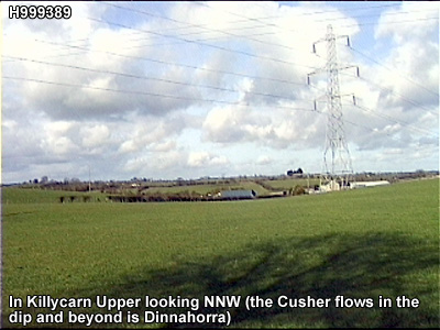
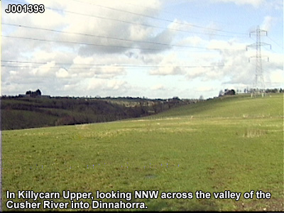
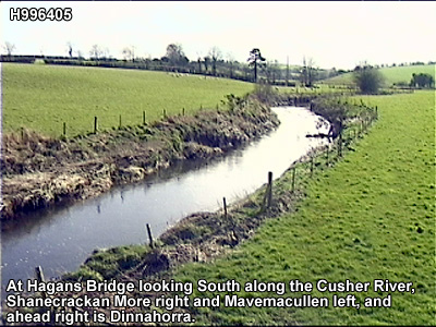
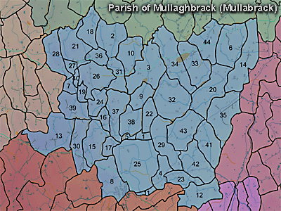
The townland of Dinnahorra is in the parish of Mullaghbrack in Armagh County. It is labelled number 12 on the map.
The Environment and Heritage Service Sites and Monuments Record (2002) notes the following in this townland:
Enclosure of uncertain period
SMR NO: ARM 017:011
GRIDREF: H98653984
CONDITION: NO VISIBLE REMAINS
"A rather irregular oval earthwork C.50m N-S and 38m E-W is shown on the 1863 OS 6" map. It was site[d] on a small eminence above a stream which marks the townland boundary. A steep natural scarp surmounted by a modern hedge bank is all that survives, probably reflecting the W side of the monument."Rath of the Early Christian Period.
SMR NO: ARM 017:035
GRIDREF: H99223966
CONDITION: SOME REMAINS
"A circular "Fort" is shown on the 1835 OS 6" map, but only "Site of Fort" is indicated on the 1863 edition. The site is bisected by a hedge bank & to the N of this a low platform 41.5m EW can still be recognised. It is defined on the W & N by the arc of a gently scarp failing c.0.6m to the ground level. On the E the line of the perimeter is preserved in a curving held boundary and there is a much steeper scarp faliing 1.5m. The nearby deserted settlement probably accounts for the destruction of the S side."
PRONI records: OS/6/2/17/1 (Surveyed 1835. Engraved 1835.); OS/6/2/17/2 (Surveyed 1835. Engraved 1835. Revised 1860. Engraved 1863.); OS/6/2/17/3 (Surveyed 1835. Revised 1906. Published 1908. Reprinted 1929, 1932.); OS/6/2/17/4 (Surveyed 1906. Revised 1954-5. Levelled 1889, 1892 and 1906. Published 1958 (2 copies).); VAL/1B/231 (1st valuation records.); VAL/12B/11/3A, VAL/12B/11/3B, VAL/12B/11/3C, VAL/12B/11/3D, VAL/12B/11/3E (Valuation annual revision list.); VAL/2B/2/29 (Griffith valuation list.); D.1607/5-6 [see also D.1607/14]C 1920 (Leases, deeds, rentals, accounts, I.L.C., sale papers and correspondence.).
H991398