 H951416
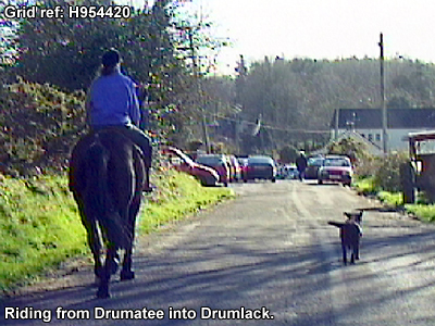
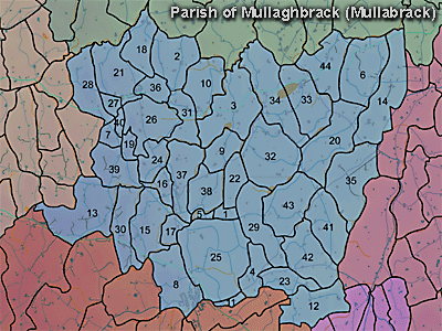
The townland of Drumatee is in the parish of Mullaghbrack in Armagh County. It is labelled number 15 on the map.
Paterson (Armachiana, Vol. 16, p.21) notes:
The Environment and Heritage Service Sites and Monuments Record (2002) notes the following in this townland:
Cleeland's Fort, a rath of the Early Christian Period.
SMR NO: ARM 017:042
GRIDREF: H95064155
CONDITION: SOME REMAINS
"An oval platform c.30m E-W x c.35.5m N-S. Around the S & W a low bank & modern hedge curve round the edge of the platform. Beyond this is a steep scarp falling 1.8m to the base of an external ditch c.2.5m wide x 0.5m deep. The E side is marked by a bank 1.8m wide & 0.2m high -this may not be original. The N side is also uncertain. A hedge boundary may preserve this section, but a slight scarp 14m S of this may be the original edge. Erosion by cattle has revealed stone in the bank - see SM7 for details."
PRONI records: D.1644 (Expired leases of Earl of Charlemont's estate.); OS/6/2/17/1 (Surveyed 1835. Engraved 1835.); OS/6/2/17/2 (Surveyed 1835. Engraved 1835. Revised 1860. Engraved 1863.); OS/6/2/17/3 (Surveyed 1835. Revised 1906. Published 1908. Reprinted 1929, 1932.); OS/6/2/17/4 (Surveyed 1906. Revised 1954-5. Levelled 1889, 1892 and 1906. Published 1958 (2 copies).); VAL/1B/213 (1st valuation records.); VAL/12B/10/24A, VAL/12B/10/24B, VAL/12B/10/24C, VAL/12B/10/24D, VAL/12B/10/29D (Valuation annual revision list.); VAL/2B/2/12A (Griffith valuation list.).
H951416