 H884399
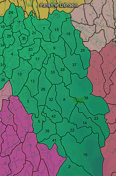
The townland of Lisnadill is in the parish of Lisnadill in Armagh County. It is labelled number 33 on the map.
The 1826 Schools Commission report describes the school in the townland:
"Lisnadill - A pay school under the care of Joseph Devlin, of the Church of Ireland denomination, who was in receipt of 22l per annum, including 6l as parish clerk. The school educated 54 scholars. The school was under the direction of the Parish School Association for Discountenancing Vice. Primate Robinson supplied money for the construction of the school."
The Environment and Heritage Service Sites and Monuments Record (2002) notes the following in this townland:
Stone of uncertain period.
SMR NO: ARM 016:056
Irish Grid Reference: H88464052
Sitename: BULLS TRACK
Townland: LISNADILL
CONDITION: No visible remains
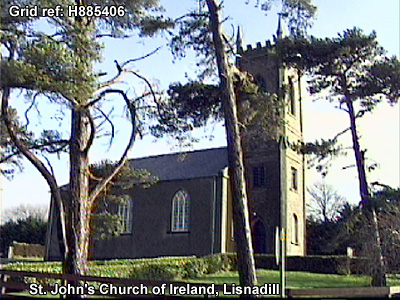
In the graveyard is "an indented stone" similar to ARM 016:042, which local tradition associates with Maeve. According to Lewis there was an ancient church at the site "destroyed in the war of 1641". No further details available.
BIBLIOGRAPHY:
LEWIS, S.1837, Vol. II, 286
PSAMNI, 1940, 70
Enclosure of uncertain period
SMR NO: ARM 016:065
Irish Grid Reference: H881399
Townland: LISNADILL
In manuscript notes on this townland, Paterson mentions a 2nd fort' located on Mr. Moore's farm. He describes it as dismantled, but with the ring (plafform) still visible and forming part of the boundary of the field in which it was situated. The site has not been precisely located.
Linear earthwork of prehistoric period.
SMR NO: ARM 016:067
Irish Grid Reference: H88323932
Sitename: THE DANES CAST, THE DANES CAST (NORTH)
Townland: LISNADILL
CONDITION: substantial remains
This is a portion of the Dane's Cast, a linear earthwork dating from the closing centuries of the prehistoric period. It is traditionally associated withthe Navan enclosure and may have funtioned as some form of barrier. Grid refs: this portion extends from H8828 3926 at SW to H8838 3940 NE
Cropmark enclosure of uncertain period on aerial photo.
SMR NO: ARM 016:075
Irish Grid Reference: H88433917
Townland: LISNADILL
CONDITION: traces only
A circular enclosure, c.40m in diameter, partially defined as a ditched cropmark, and partially by a curve in the field boundary. The interior of the enclosure is domed. It lies under grass/crops on a small knoll. Not visited.
PRONI records: T.848, p.23 (View of archbishopric of Armagh re fort.); D.266 (Leases re area.); D.902 (Volume of references and valuation, Maxwell estate.); D.874 (Title deed to Lisnadill bleaching mill.); D.1616 (Legal papers re Sinn Fein raid at Lisnadill Rectory.); VAL/1B/234, VAL/1B/241 (1st valuation records.); VAL/12B/10/32A, VAL/12B/10/32B, VAL/12B/10/32C, VAL/12B/10/32D, VAL/12B/10/32E (Valuation annual revision list.); VAL/2B/2/10B (Griffith valuation list.).
 H884399


