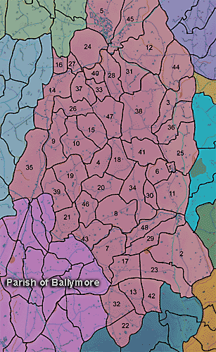
The townland of Lisraw is in the parish of Ballymore in Armagh County. It is labelled number 34 on the map.
Paterson (Armachiana, Vol. 16, p.25) notes:
...Rath, lis, etc. denote ringed enclosures ['rath' or 'fort'] and in their various forms are common throughout the county...
The Environment and Heritage Service Sites and Monuments Record (2002) notes the following in this townland:
Rath of the Early Christian Period.
SMR NO: ARM 018:017
Irish Grid Reference: J04893979
Townland: LISRAW
CONDITION: traces only
An oval "Fort" c.50m NE-SW x 50m NW-SE is shown on the 1835 OS 6" map but but the time of the 1863 edition only a "Site of Fort" is recorded. Only faint traces of a low platform survive. The S side can no longer be traced & on the W only a hint of a scarp can be seen. A field boundary has cut across the curve of the site to N & only on NE may part of the original perimeter have survived. Here there is a low bank 2m wide, 0.5m above the interior & 1.7m above the base of a ditch which forms the t'land boundary.
PRONI records: OS/6/2/18/1 (Surveyed 1835. Engraved 1835.); OS/6/2/18/2 (Surveyed 1835. Engraved 1835. Revised 1860. Engraved 1863.); OS/6/2/18/3 (Surveyed 1835. Revised 1906. Published 1908.); OS/6/2/18/4 (Surveyed 1835. Revised 1906. Published 1908. (2 copies - 1st a reprint 1930, 1933 and 2nd reprint 1933, 1939, 1942, 1946, 1955.); OS/6/2/18/5 (Surveyed 1906. Revised 1954-5. Levelled 1892, 1901-2, 1904 and 1906. Published 1958 (2 copies).); VAL/1B/214 (1st valuation records.); VAL/12B/15/23D, VAL/12B/15/23E (Valuation annual revision list.); VAL/2B/2/32C (Griffith valuation list.); VAL/12B/15/23A, VAL/12B/15/23B, VAL/12B/15/23C (Valuation annual revision list.).