 H983385
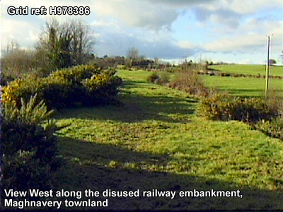
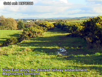
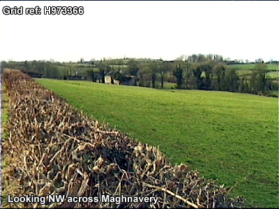
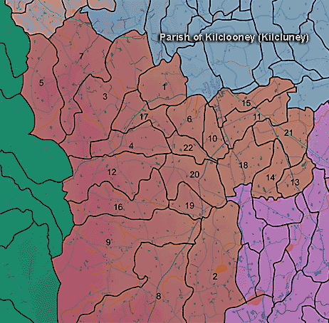
The townland of Maghnavery is in the parish of Kilclooney in Armagh County. It is labelled number 21 on the map.
The Environment and Heritage Service Sites and Monuments Record (2002) notes the following in this townland:
Rath of the Early Christian Period.
SMR NO: ARM 017:024
GRIDREF: H98723793
CONDITION: SOME REMAINS
"The eliptical interior of this site is raised 1-2m above ground level to create a level platform on the slope, enclosed by an earthen bank and external ditch. A short length of bank on the NW has been levelled but is otherwise well preserved: in places it stands 1m above the interior & is 5m wide. The ditch is also 5m wide x 0.5m deep. Both bank & ditch are most substantial to the N & W. An entrance at SE, probably original, is marked by a break in the bank & a causeway over the ditch. It is48m N-S x 39.5m E-W. "Rath of the Early Christian Period.
SMR NO: ARM 017:026
GRIDREF: H97673648
CONDITION: SOME REMAINS
"The site has been extensively damaged by cultivation, but a low roughly circular platform, raised 0.51m above surrounding ground level can still be seen. This measures 50m E-W x 56m N-S. To the E there is a ditch 2:3m wide & 0.4m deep, probably recut to assist drainage. Faint traces of a ditch can also be seen to the W. A mound of earth and stone on the perimeter to the SE appears to be the result of recent disturbance."Rath of the Early Christian Period.
SMR NO: ARM 017:027
GRIDREF: H97793833
CONDITION: SOME REMAINS
"The profile of this monument has been much eroded by cultivation and in places it is impossible to distinguish between the site & the natural slope. An oval platform 42.5m N-S x 37m E-W slopes down towards the SE. To the W the perimeter is defined by a gentle scarp which falls O.9m to the external ground level, whilst to the E there is a more pronounced drop of almost 2m. At the S end are remains of a possible ramped entrance. Field notes of 1960s record traces of an external ditch, no longer visible."
PRONI records: D.3000/30 (Genealogical table of Flack family.); OS/6/2/17/1 (Surveyed 1835. Engraved 1835.); OS/6/2/17/2 (Surveyed 1835. Engraved 1835. Revised 1860. Engraved 1863.); OS/6/2/17/3 (Surveyed 1835. Revised 1906. Published 1908. Reprinted 1929, 1932.); OS/6/2/17/4 (Surveyed 1906. Revised 1954-5. Levelled 1889, 1892 and 1906. Published 1958 (2 copies).); VAL/12B/10/34A, VAL/12B/10/34B, VAL/12B/10/34C, VAL/12B/10/21A, VAL/12B/10/21B (Valuation annual revision list.); VAL/2B/2/9A (Griffith valuation list.).
H983385