 H993358
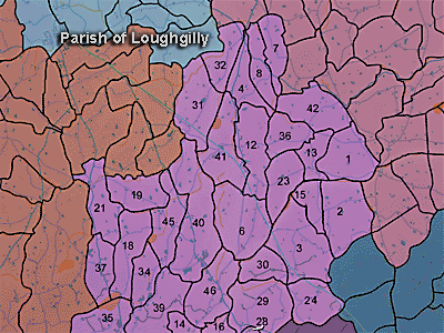
The townland of Mountnorris is in the parish of Loughgilly in Armagh County. It is labelled number 40 on the map.
The 1826 Schools Commission report describes the school in the townland:
"Mountnorris - A pay school under the care of King Murray, of the Presbyterian denomination, who was in receipt of 14l per annum. The school was provided free of charge by the local congregation and used to educate 24 scholars. "
The Environment and Heritage Service Sites and Monuments Record (2002) notes the following in this townland:
Rath of the Early Christian Period.
SMR NO: ARM 021:008
Irish Grid Reference: H99233460
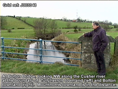
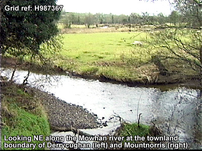
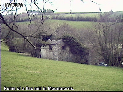
Townland: MOUNTNORRIS
CONDITION: destroyed
A slightly oval "Fort" c.35m NW-SE x 40m NE-SW is marked on the 1835 OS 6" map & a similar earthwork is indicated on the map of 1863. It was sited on the S end of a prominent ridge, but the area is now occupied by large battery hen houses, & no trace of any antiquity survives. Before its final destruction the remains were described during the field survey of 1960s. There was a low platform raised c.1.2m surrounded by a bank 0.4-0.6m high. There was no sign of a ditch or an entrance said to be on the S side.
Rath of the Early Christian Period.
SMR NO: ARM 021:003
Irish Grid Reference: H99373552
Townland: MOUNTNORRIS
CONDITION: some remains
An oval earthwork, 43.5m N-S x 53m E-W has survived as an small field. A low spread bank, upto 5m wide & 0.6m high defines the N, W & S sides, & this is surrounded by a recut ditch c.2m wide, 1.5m deep below the top of the bank & c.1 m below external ground level. The bank is interrupted in several places, but the larger gap on N may mark an original entrance. The E half of the site has been raised to create a level interior. Consequently the E perimeter is marked simply by a scarp falling 1.5m.
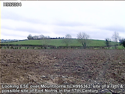
ARTILLERY FORT of the Seventeenth Century
SMR NO: ARM 021:045
Irish Grid Reference: H9935
Sitename: PORT-NORRIS, MOUNT-NORRIS
Townland: MOUNTNORRIS
CONDITION: No visible remains
According to Lewis in 1837 "of the extensive fortress of Port-Norris or Mount-Norris not a
vestige can be traced. " No futher details are available and the site can not be precisely located
BIBLIOGRAPHY:
J. R. S. A. I., XVI, 1883, 321
ROCQUE'S MAP 1760
UJA Vol. 16, 62
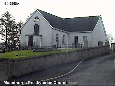
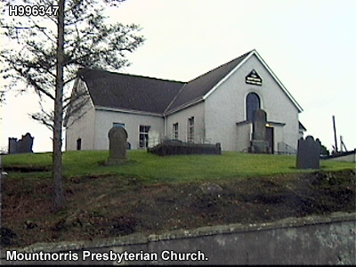
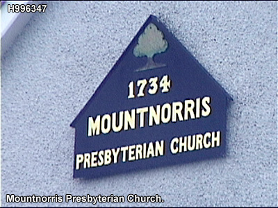
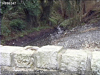
PRONI records: RGO.13/135/1 (Register of births.); RGO.15/135/1 (Register of deaths.); VAL.12E/54/1-2C 1935 (Annual revision town plans.); T.3225C 1903 (Papers of Morgan family.); D.1607/7; D.1606/9A/5C 1890 (Surveys, valuations, rentals, land court sale papers and correspondence re "school lands".); T.1244 (Maps by Richard Barthelet re military installations.C 1600); T.1614 (Domestic account book of Magowan family.); T.1614 (Address from congregation [Presbyterian] to theirnew minister, Rev. Wm Magowan.); T.1614 (Correspondence between James Magowan, Mountnorrisand Mary Kidd, Donaghmore.); MIC.1P/29 (Baptisms of Mountnorris Presbyterian Church.); MIC.1P/29 (Marriages of Mountnorris Presbyterian Church.); D.552/91 (Appointment of Patrick Savage as seneschal of manor of Mountnorris.); T.1017, p.3 (T.S.P.I. referring to title of baron of Mountnorris.); T.1244/14 (Map [by Richard Barthelet] re Mountnorris Fort.C [ 1602 ]); MIC.206 (Deed.); OS/6/2/17/1 (Surveyed 1835. Engraved 1835.); OS/6/2/17/2 (Surveyed 1835. Engraved 1835. Revised 1860. Engraved 1863.); OS/6/2/17/3 (Surveyed 1835. Revised 1906. Published 1908. Reprinted 1929, 1932.); OS/6/2/17/4 (Surveyed 1906. Revised 1954-5. Levelled 1889, 1892 and 1906. Published 1958 (2 copies).); OS/6/2/21/1 (Surveyed 1834-35. Engraved 1835.); OS/6/2/21/2 (Surveyed 1834-35. Engraved 1835. Revised 1860. Revisions engraved 1863.); OS/6/2/21/3 (Surveyed 1834-35. Revised 1906. Published 1908. Reprinted 1921.); OS/6/2/21/4 (Surveyed 1834-35. Revised 1906. Published 1908. (2 copies), Reprints 1934-1957.); OS/6/2/21/5 (Surveyed 1906. Revised 1955. Levelled 1889 and 1906. Published 1958.); VAL/1B/219 (1st valuation records.); VAL/12B/15/19A, VAL/12B/15/19B, VAL/12B/15/19C, VAL/12B/15/19D, VAL/12B/15/19E (Valuation annual revision list.); VAL/2B/2/34B (Griffith valuation list.); T/3225/2 (Details re Mountnorris Presbyterian Church.).
H993358
In the accompany recording, Joseph Canning talks about the fort and village at Mountnorris and the plan for a Royal School there.

Use the audio controller to listen to this talk, given in 2003.


The construction of a fort at Mountnorris in 1600 was the first step in a strategy by Crown forces to pin down Irish forces in the area and protect their Newry-Armagh supply route.
Fynes Moryson, secretary to Mountjoy, gave an account of the siting and construction of the fort at Mountnorris (described by Joseph Canning in his talk above).
Then after the army was a few daies refreshed at Dundalke, his Lordship marched the twenty one of October [1600] to the Newry, passing through the Moyry, where he caused all the rebels trenches too be laid flat to the ground, and the woods to be cut downe on both sides of the Pace. At the Newry for want of victuals, his Lordship staied till the second of November, when he set forward eight miles towards Armagh, and there incamped. The Rebels horse-men shewed themselves upon a hil; whereupon Sir Samuel Bagnols Regiment having the Reare, and being not yet come into the Campe, was directed to march towardes them, there being a bog between us and them, but the Rogues quickly drew to their fastnes. The next morning his Lordship rode some quarter of a mile from the Campe, and viewed a place where Sir John Norreys formerly intended to build a Fort, and liking his choice, set downe therewith the Army to build the same. The place is a hill like a Promontory, all invironed with bogges, a River, and great store of wood. By it on the right hand over the River and a great bogge, was a little firme ground, and then another bogge, & over that a faire Countrey, with houses and much corne. His Lordship could by no meanes send over any horse, but foure miles about; wherefore he commanded a regiment of foote to advance to the first peece of firme ground, and from thence to send over the next bogge some few men, to bring in the Corne and Tymber of the houses, with directions to make their retreit to the grosse, if the enemies horses should fall downe that way. On the left hand and before was a bogge, over the bogge before a great wood, that continueth through all this fastnes, and over the bogge on the left hand a hill, where Tyrone all that day and most of the time that the Army lay there, did muster himselfe and his men. This day most of his horse and foote fell over, but farre about on the right hand, upon which, our straglers that went out retired to the firme ground, over the first bogge, and there beganne betweene our foote and theirs, a very good skirmish, till our men did beate them off, and brought with them great store of Corne and wood, and killed [II. i. 82.] divers of them. In the meane time, their scouts on the other side being somewhat busie with ours, Neal Oquin was taken prisoner, being the chiefe favourite unto Tyrone. The next day we beganne to worke, in the building of the Fort, and to impeach our worke, the rogues beganne to skirmish with us on both sides, which was excellently maintained by some few of our men, that we sent out: We saw many of them killed, and after understood they lost a great number, whereof many were horsemen, of the best sort, that had lighted to incourage their men to fight. They were then so well beaten, as they would never after offer to meddle with us, till our returne by Carlingford. The ninth of November the Fort being finished, his Lordship called it Mount Norreys, in honour of his Master, (so he tearmed him, under whom hee had served his apprentiship in the warres), and he left therein foure hundred foot, under the command of Captaine Edward Blaney, with six weekes provision of victuals. The weather grew so extreame, as it blew downe all our Tents, and tore them in pieces, and killed many of our horses, so that the tenth day his Lordship putting all the Army in armes, with all the Drummes and Trumpets, and a great volly of shot, proclaimed Tyrones head, (with promise of 2000. pound to him that brought him alive, and 1000. pound to him that brought him dead), which was done in the face of his own army, and so his Lordship marched to the Newry. He had purposed to plant a garrison at Armagh 8. miles beyond Mount Norryes, but the rebels Cowes had eaten up all the grasse thereabouts, which should have fed our horses, and the time of the yeere with the weather, was now unseasonable for that purpose. (Fynes Moryson, An Itinerary, II.i.81.)
Sir Griffin Markham likewise gave an account of the siting and construction of the fort at Mountnorris in a letter to Cecil.
19. Sir Griffin Markham to Sir Robert Cecil. [November 8, 1600, Newry]
" After I had received your honourable despatch, I was much crossed and detained in England, first by the sickness of my mother in the country, afterwards by a bruit of some extremity my father was in, which drew me from Chester almost to London, and lastly, by the crossness of the winds so long, as by no means I could arrive at the army at Dundalk, before my Lord was ready to rise to go forwards towards Armagh ; so as whatsoever passed before that time I was no witness of, nor dare undertake to relate. But since that till this day, and so far as I may presume by your Honour's favour to guess at a sequel, I will (so far as I can in this haste remember)
truly set down." The 21 October, my Lord rose from Dundalk and encamped in the Moyerie, where Tyrone lay so long to fight with him. There he lay all night unfought withal, and the next day removed near to the Newry, where we lay in camp attending victuals, and providing necessaries for a further journey, till the first of November, upon which day we marched seven or eight miles from the Newry. We encamped upon a hill, on the top whereof my Lord Deputy found a piece of ground anciently raised in a round form in the nature of a fortification, which might save some labour in the work, and gain so much time, which in this season of the year, our men every day weakening, is very precious. Finding the situation in his opinion at the first view very commodious for wood, water, and discovery, not far from the high way betwixt the Newry and Armagh, and fit for the relief of any forces that should be sent from the Newry to prey the country, [he] resolved there to settle the garrison, and made Captain Hansard, who beareth the place of Trenchmaster, to draw divers plots for such a ground, but whilst those plots were drawing, the Council being called, some of them being by their long continuance better experienced in these parts, drew my Lord the next day, being the third of November, about half-a-mile back again to another hill with a round fort, whereof there are very many, as it is thought, made by the Danes. This being upon view held the better place, as well watered and better wooded, was by general consent elected, and order given to the camp to retire thither ; where we were no sooner beginning to settle, but skirmish was entertained of both sides, coldly, by the enemy, as it should seem rather to hinder us from working, than with any opinion to do us hurt. This day, Tyrone, belike determining to make his men show their bravery, armed them so heavily with drink as some of them were so unable to retire, that one of our guards of horse with very small hazard to themselves and hurt to him, took one Neale 0'Quin, one of his best trusted servants, who, it is known, may do as good service to the State as almost any towards him, having long had command of some of his islands, and been trusted with most of his prisoners. Upon his taking there was no examination of him, drink had made him both so senseless and speechless. Since, he hath been examined, and, as it is muttered, hath promised something, whereupon he is yet preserved. From that day till the seventh of November we lay still, little troubled with skirmishing, and diligently working. The fort which we found was doubleditched, both deep enough, and easily made defensible against this enemy. The quantity of the plain within the second ditch was about thirty yards every way, and by casting down some parts of the inner parapet as it shall be found convenient to fill the ditch, it will be made spacious enough to lodge four or live hundred men. The form is reformed, not much altered, being cut to carry a show of eight angles, which we are driven to perfect with eight cadgehouses set upon poles fastened in the ramparts, which will make it both proportionable and defensible.
"I was determined at the end of this journey to have presented your Honour with the plots, but my Lord being enforced (for want of victuals, both for the present and to leave behind him) to come to the Newry the seventh of this month, and unexpectedly finding a messenger here, I thought it my duty for so many obligations to show my diligence, and having nothing here to draw a plot, to send this, and omit the other till our return. We were no sooner come to the Newry, but word was brought that Tyrone had followed us all day, and was gone to repossess the Moyerie, as it should seem wanting true intelligence of our return, and meaning to fight with us when he hath fortified himself. He had need seek advantages, for the numbers he showeth are very small. We found yesternight, upon our arrival here, part of the victuals, and this day arrived all the rest, so as to-morrow, being the ninth of this month, my Lord determineth his return to finish the fort, and that done, to view the place at Armagh, and so return to Leinster. The conveniences of this fort are many, as to win intelligence, to subject the whole country betwixt it and the Newry, a retreat for any forces that prey thereabouts, an excellent step to victual the fort at Armagh, whensoever it shall be planted, and a means that Tyrone dare not employ all his forces upon Lough Foyle. So as if Ballyshannon were strongly planted to dissever O'Donnell from him, I leave to your honourable judgment with what facility Ulster may, with the help of the other garrisons, be supplied. If it please God to send us but reasonable weather for this small time we have to tarry, that our men hold in any measure their willingness to fight is so good, and the fortune of our general so great, as we need not fear all the force the enemy can make."
Trusts the foregoing particulars will be pleasing to Sir Robert." I sent your honourable and favourable letter to my Lord by one of my servants, which he promised to answer at my coming. This made me hope well, but when I expected to have found an increase of my fortune, I found myself much disgraced by an absolute cast. My Lord giveth me good words, but my sole hope is in your honourable favour." Begs Sir Robert to think upon him, as he shall find opportunity. Newry, November 8. Endorsed: 1600.
Signed, pp. 3 [and a half].Source: E.G. Atkinson (ed.) Calendar of the State Papers Relating to Ireland, of the Reigh of Elizabeth, 1 November 1600—31 July, 1601 (London, 1905)
In this letter of 14 November 1600 from Dublin, Sir Ralph Lane giives the name of the site of the fort as at the Aughenegrane but this may not be reliable. He says the site of the fort is at the Eight Miles Church but Eight Miles Church is noted on a map of the period as being the church at Ballymoyer, five miles away to the South East. Loughgilly Church (shown as a ruin on a contemporary map) is indeed about eight miles from Newry, two miles beyond Six Mile Bridge (McCready's Bridge today) and a mile from Mountnorris fort.
21. Sir Ralph Lane to Sir Robert Cecil. [14 November 1600, Dublin] "As the particularities of my Lord Deputy's fortunes, that he hath run with Her Majesty's army, in the late endeavour of the passage of it through the pass of the Moyerie, strongly barricaded by the Archtraitor, yet for a time (for the refreshing of his rascals) abandoned by him, and in that time passed by his Lordship with Her Majesty's army to the Newry, and from thence to the Aughenegrane, at the eight miles church* midway betwixt the Newry and Armagh, where his Lordship hath raised a fort, are, I am sure, better made known to your Honour by Sir Oliver St. John, who was a personal actor in it with deserved good commendation, than I, being absent from it, will take upon me, upon any report of what good credit soever, to be an advertiser of to your Honour..."
Source: E.G. Atkinson (ed.) Calendar of the State Papers Relating to Ireland, of the Reigh of Elizabeth, 1 November 1600—31 July, 1601 (London, 1905)
(*Lane account seems McCreedy's bridge today was then called Six Mile Bridge, being six miles from Newry, the Eight Miles church however was Loughgilly Church, eight miles from Newry. )

The above map of Mountnorris Fort was made by Richard Bartlett after the fort was extended in 1601. You can see from the map how the fort was built in three stages: first, the fortification of the ring fort, then the seven-sided enclosure, then a further perimeter wall. The map and a account of the fort's construction are in G.A. Hayes-McCoy, Ulster and Other Irish Maps c.1600 (Dublin, 1964) pp.2-4.
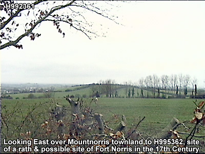
We can see how accourate this description is for the site of the fort at grid reference H995362.
Note how what was once extensive woodland in the area has been cleared.

The aerial photo and water data depicted in the accompanying images are © Environment and Heritage Agency and Land Service Northern Ireland, 2006.


Photos of the site with and without Bartlett's map of the fort superimposed.