 H959428
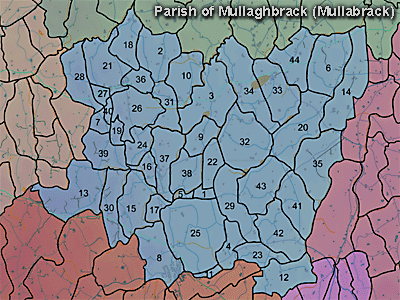
The townland of Mullaghbrack (or Mullabrack) is in the parish of Mullaghbrack in Armagh County. It is labelled number 37 on the map.
Paterson (Armachiana, Vol. 16, p.24) notes:
...Mullach signifies the top or summit, and as a root word it forms the beginning of upwards of 400 names.
The 1826 Schools Commission report describes the school in the townland:
"Mullabrack - A pay school under the care of Joseph Wallace, of the Church of Ireland denomination, who was in receipt of 17l per annum. The school was under the patronage of the local parish church, the incumbent of which paid the master 2l 5s 6d per annum. The school provided education for 18 scholars."
The Environment and Heritage Service Sites and Monuments Record (2002) notes the following in this townland:
Enclosure of uncertain period
SMR NO: ARM 017:011
GRIDREF: H98653984
CONDITION: NO VISIBLE REMAINS
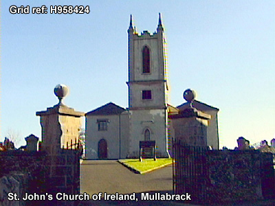
"A rather irregular oval earthwork C.50m N-S and 38m E-W is shown on the 1863 OS 6" map. It was site[d] on a small eminence above a stream which marks the townland boundary. A steep natural scarp surmounted by a modern hedge bank is all that survives, probably reflecting the W side of the monument."St. John's, Mullaghbrack.
Ecclesiastical Site in use from Early Christian times to the present.
SMR NO: ARM 017:037
GRIDREF: H95824232
CONDITION: TRACES ONLY (of use before modern times)
The modern church & graveyard occupy a medieval & possibly earlier site. The only early material was a cross-carved stone found during grave digging. A church with a W tower is shown on Bodley's 1609 map. The modern church & part of the graveyard stand above a steep platform edge falling 2.5m to the rest of the graveyard SW-S-SE. The pronounced edge fades and eventually merges into the hill at NE. Traces of a ditch were noted in the 1960s but can not be seen now. See SM7 file for further details. BIBLIOGRAPHY:
HAMLIN,A.E. 1976, THESIS (UNPUBLISHED), 529-30 HILL,G. 1877, 284
LESLIE, ARMAGH CLERGY & PARISHES, 1911, 382-6 PATERSON,T.G.F. UJA 1946, 48 & PL.IIIB
REEVES,W. 1989, 216
SCOTT, 1896, 246-7
PRONI records: D.943 (Commonplace book kept by Rev. Squire Barker, including genealogical notes of Barker family.); MIC.144C 1900 (Genealogical notes re Beck family.C 1631); D.1594 (Copy will of John McCammon.); D.1601 (Genealogical tables.C 1200); T.1202 (Genealogical notes re Beck family.); T.1827 (Notices re collection of tithes.); VAL/1B/29A, VAL/1B/213, VAL/1B/234 (1st valuation records.); VAL/12B/10/24A, VAL/12B/10/24B, VAL/12B/10/24C, VAL/12B/10/24D (Valuation annual revision list.); VAL/2B/2/12A (Griffith valuation list.).
H959428