 J027389
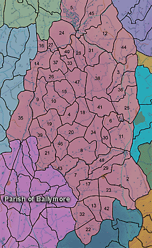
The townland of Tannyoky is in the parish of Ballymore in Armagh County. It is labelled number 43 on the map.
The Environment and Heritage Service Sites and Monuments Record (2002) notes the following in this townland:
Rath & souterrain? of the Early Christian Period.
SMR NO: ARM 018:020
Townland: TANNYOKY
CONDITION: some remains
An oval platform 31 m N-S x 34m E-W has been levelled out on the edge of a steep drop. The interior slopes down to the E & is enclosed to the W by an earth & clay bank 1.1 m high x c.3m wide surmounted by a hedge. Elsewhere the bank is lower & the S perimeter is marked only by a scarp falling c.1.5m to ground level. Much stone is visible in the outer face of the scarp. Reports of 1 960s state that a possible vent for a souterrain was visible on the outer face of the bank at SE. See SM7 file for further details.
PRONI records: VAL/1B/214 (1st Valuation Records); OS/6/2/17/1 (Surveyed 1835. Engraved 1835.); OS/6/2/17/2 (Surveyed 1835. Engraved 1835. Revised 1860. Engraved 1863.); OS/6/2/17/3 (Surveyed 1835. Revised 1906. Published 1908. Reprinted 1929, 1932.); OS/6/2/17/4 (Surveyed 1906. Revised 1954-5. Levelled 1889, 1892 and 1906. Published 1958 (2 copies).); OS/6/2/18/1 (Surveyed 1835. Engraved 1835.); OS/6/2/18/2 (Surveyed 1835. Engraved 1835. Revised 1860. Engraved 1863.); OS/6/2/18/3 (Surveyed 1835. Revised 1906. Published 1908.); OS/6/2/18/4 (Surveyed 1835. Revised 1906. Published 1908. (2 copies - 1st a reprint 1930, 1933 and 2nd reprint 1933, 1939, 1942, 1946, 1955.); OS/6/2/18/5 (Surveyed 1906. Revised 1954-5. Levelled 1892, 1901-2, 1904 and 1906. Published 1958 (2 copies).); VAL/12B/15/23A, VAL/12B/15/23B, VAL/12B/15/23C, VAL/12B/15/23D, VAL/12B/15/23E (Valuation annual revision list.); VAL/2B/2/32C (Griffith valuation list.).
J027389